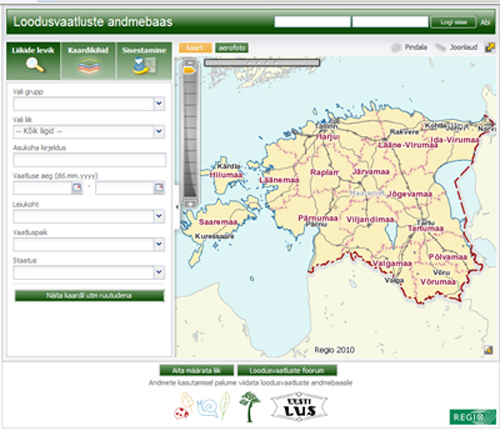
THE MAP APPLICATION OF THE DATABASE
The Nature Observations Database has a map application,
which shows entered observations, borders of the protected areas and locations
of protected nature monuments in Estonia. You can also see the locations of
protected areas prohibited to enter and distribution of big groups of habitats
(like forests, mires, grasslands and argicultural land) following from CORINE
LandCover.
The observations submitted to the database and information
on the map are not official. However, the maplayers of nature conservation are
official - these are based on the Estonian environmental register.
The map application of the Nature Observations Database was
originally created by Regio AS.
Click on the picture below to access the map application.